 |
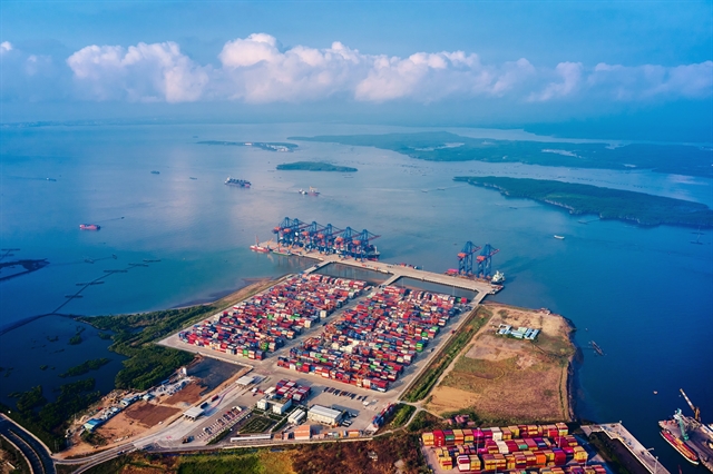
| Việt Nam's administrative rearrangement plan aims to connect localities without a coastline with seaside areas to create more space for development. — VNA/VNS Photo Hồng Đạt |
HÀ NỘI — With the number of cities and provinces across Việt Nam planned to be reduced by half within the year, experts believe that the impacts of this rearrangement will present opportunities to create new marine-centred development spaces.
This topic was a main focus at recent talks on the matter in Hà Nội that brought together officials and various stakeholders to discuss how these administrative unit changes can create a new momentum for national growth.
According to Phan Trung Tuấn, head of the Department of Local Government under the Ministry of Home Affairs, the Party Central Committee, the National Assembly and the Government had considered carefully before determining that this is the right time to rearrange the country’s administrative units.
“The research did not start only a few months ago, it has been in discussion since the 13th National Party Congress. We have made thorough preparations over an extended period,” said Tuấn.
“We also prepared the proposal with urgency and thoughtful deliberation. All the factors to ensure the feasibility of the mergers have been considered to ensure the strategy can proceed for the next hundred or even several hundred years,” he stressed.
Expanding development space is one of the major goals, Tuấn explained, but many other issues must be considered, such as geography, culture and regional and inter-regional planning.
Another objective is to build a streamlined apparatus that operates efficiently and effectively, as Party chief Tô Lâm has pointed out.
As for the sea-oriented development strategy, Tuấn believes that merging inland regions with coastal areas is consistent with the country’s national development policies, as Việt Nam has an extensive coastline and vast waters.
The country’s recent socio-economic development has also aligned with this strategy, as reflected in the planning of major transport and railway routes that are linked to coastal zones.
“The sea-oriented factor is extremely important. In this proposal submitted to the central authorities, we have suggested a merger plan that connects cities and provinces without a coastline with seaside areas to create development space for the localities,” Tuấn explained.
Development space is not only about scale and size but also includes other factors that ensure long-term development goals related to the sea, he added.
He said: “For example, the Central Highlands currently has no coastline. In this merger plan, we aim to connect the region with coastal areas to take full advantage of its land resource potential, and develop these famous agricultural areas of the country.”
With its current 63 cities and provinces, Việt Nam has 28 localities with coastlines, all of which have seaports, except for Ninh Bình and Bạc Liêu.
The country also has eight non-coastal cities and provinces with inland ports.
According to Resolution 60 of the 11th plenum of the 13th Party Central Committee, Việt Nam will merge its administrative units to reduce the number of localities from 63 to 34, including 28 provinces and six centrally governed cities.
This means Việt Nam will have only 21 coastal provinces compared to the current 28. However, the proportion of cities and provinces with coastlines after the mergers will increase from 44 per cent (28 out of 63 localities) to 62 per cent (21 out of 34 localities).
Among these, 21 coastal cities and provinces have seaports, while two provinces without a coastline (new Đồng Nai and Tây Ninh) will have inland ports.
From a planning perspective, Trần Ngọc Chính, chairman of the Vietnam Urban Planning and Development Association (VUPDA) and former Deputy Minister of Construction, said that the directive to connect inland provinces -- especially highland areas like the Central Highlands -- with coastal localities is a strategic planning mindset that fits the current context of integrated development.
The Central Highlands currently consists of five provinces covering a total area of over 50,000 square kilometres that is home to a population of about six million people.
However, what is considered more important than the region’s population or land area is its strategic value, which lies in its unique cultural identities, distinct climate, and abundant natural resources.
This region is the starting point for many large rivers, such as the Sê San and the Đồng Nai rivers, that are crucial for the socio-economic development of the central coastal and southeastern regions. They not only have value in terms of irrigation and energy but also contribute to the natural and economic connectivity between regions.
Most people often think of the Central Highlands as a land of majestic forests, the home of vast plateaus such as Kon Tum, Di Linh and Buôn Ma Thuột. However, although these plateaus are geographically adjacent, the area is fragmented by rugged terrain.
Chính said that during the research and development of Việt Nam’s socio-economic strategies, there were times when experts and policymakers proposed dividing the Central Highlands into two separate regions.
A notable example was an idea to reassign Lâm Đồng Province to the southeastern region, as the locality has many trade, economic, cultural and tourism ties with others in that area.
Meanwhile, the northern provinces of the Central Highlands could have been merged with the south-central coastal area, due to the key strategic transportation routes they share with the region.
“The idea of dividing the Central Highlands in the past partly reflected a desire to better utilise the region’s rich natural resources and to promote regional integration based on distinct growth characteristics,” said Chính.
“However, with the mindset of integrated spatial development today, the more important approach is to connect regions harmoniously and effectively, rather than merely separating them administratively,” the former deputy minister added.
Chính underscored that it is necessary to strengthen the connection between the Central Highlands and the south-central coast to form an east–west corridor, linking the coast to the mountainous regions and the lowlands to the highlands.
This connection is about not onlytransportation and logistics but also the flow of economic, cultural and historical development, which helps expand development space in a sustainable and effective manner.
This is a strategically significant factor in regional planning that requires much attention and systematic implementation. — VNS